Is Milford Sound A National Park?
People search for Milford Sound National Park every day, and the park by that name does not exist. The answer matters more than pedantry, because what Milford Sound actually sits inside changes what you can do there, who controls access, and why the place looks the way it does.
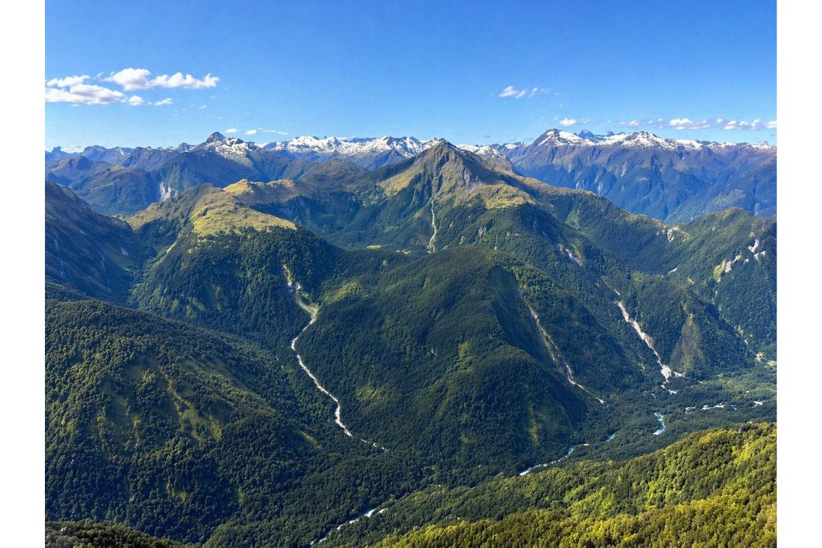
Milford Sound is not a national park. It is a single fiord inside Fiordland National Park, which covers more than 12,500 square kilometres of New Zealand's southwest and is the largest national park in the country. Milford is the most visited corner of it, and one of the few reachable by road.
Once that park relationship is clear, choose how you reach the fiord: a Te Anau road-and-cruise day, a Queenstown coach day, or a shorter flight-and-cruise, because there is no town waiting at Milford.
Your Milford Plan
- Milford Sound is a fiord inside Fiordland National Park, not a separate national park.
- Start from Te Anau if you want the Milford Road, short walks and a cruise without the longer Queenstown drive.
- Check your actual travel date before arranging nights, cars or other parts of the trip.
The confusion is understandable. Milford Sound has more name recognition than the park that contains it, so the phrase Milford Sound National Park gets typed into search bars constantly. Getting the relationship straight is genuinely useful, though. The park designation is why there is almost nothing built at Milford, why the road in is the only road in, and why the operators running boats on the water work under concession rather than owning the place.
What Is Milford Sound Actually Part Of?
Milford Sound sits at the northern end of Fiordland National Park, which is itself part of Te Wahipounamu, a UNESCO World Heritage Area inscribed in 1990 that covers roughly ten percent of New Zealand's land area across four national parks.
Fiordland National Park is administered by the Department of Conservation, the government agency responsible for New Zealand's protected land. The park contains fourteen major fiords along a coastline that is otherwise almost entirely without road access. Milford is the northernmost of the famous ones, Doubtful Sound sits to the south, and beyond that the fiords get progressively wilder and harder to reach: Dusky, Breaksea, Chalky, Preservation.
The World Heritage listing sits above the national park designation rather than replacing it. Te Wahipounamu, which translates roughly as the place of greenstone, groups Fiordland with Mount Aspiring, Westland Tai Poutini and Aoraki Mount Cook national parks. The listing recognises the landforms, the glacial geology and the survival of plant and animal lineages that trace back to the ancient supercontinent of Gondwana.
| Designation | What it covers | Who administers it |
|---|---|---|
| Milford Sound / Piopiotahi | One fiord, about 16 km from head to sea | DOC, with commercial operators under concession |
| Fiordland National Park | Over 12,500 km², New Zealand's largest national park | Department of Conservation |
| Te Wahipounamu World Heritage Area | Four national parks across the southwest South Island | UNESCO listing, administered nationally by DOC |
Why Does The National Park Status Change Your Visit?
Because almost nothing can be built. The park designation is the reason Milford Sound has a boat terminal, an airstrip, a single lodge and essentially nothing else: no town, no supermarket, no fuel station you should rely on, and phone coverage that stops well before you arrive.
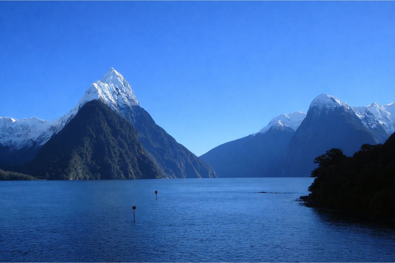
This is the practical heart of the matter. Visitors who assume Milford Sound is a destination town, in the way Queenstown or Te Anau are towns, arrive to find a car park and a terminal building. Everything else is water and rock. Planning around that reality is the single biggest difference between a good day and a frustrating one.
It also explains why the day is structured the way it is. If you cannot stay at Milford easily, you drive in and out on the same day, which means the road is part of the experience rather than an inconvenience before it. Roughly 120 kilometres separate Te Anau from Milford, and the drive takes about two hours each way without stops. From Queenstown it is closer to 290 kilometres and four hours each way, which is why the standard Queenstown day trip runs twelve to thirteen hours door to door.
The concession system matters too. Every cruise operator, kayak guide and flight company working in the fiord does so under a permit from the Department of Conservation, with caps on how many vessels can be on the water and where they can go. That is why the fiord never feels as crowded on the water as the car park suggests it should.
Is Milford Sound A Fiord Or A Sound?
It is a fiord, carved by glaciers, and the name is a historical mistake that stuck. A true sound is a river valley drowned by rising sea level. Milford was gouged out by ice over successive glaciations, which is why its walls are near-vertical and its water is unusually deep close to shore.
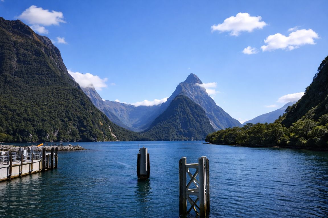
Early European sailors named several of these inlets sounds before the glacial origin was understood. New Zealand has quietly corrected the record in places, which is why you will see the spelling fiord rather than fjord in Fiordland, and why the park is Fiordland rather than Fjordland. The Norwegian spelling with a j is more familiar internationally, but the New Zealand convention drops it.
The distinction is not academic when you are looking at it. Glacial carving is what produces the U-shaped cross section, the sheer rock faces rising straight out of deep water, and the hanging valleys that feed waterfalls off the cliff tops. A drowned river valley looks nothing like this. Mitre Peak rises 1,692 metres almost directly from the waterline, which is only possible because ice removed everything that used to sit between.
How Big Is Fiordland National Park Compared With Milford Sound?
Fiordland National Park is roughly the size of a small country, and Milford Sound occupies a sliver of its northern edge. The fiord runs about 16 kilometres inland from the Tasman Sea. The park around it stretches for hundreds of kilometres of coast, most of it with no road access at all.
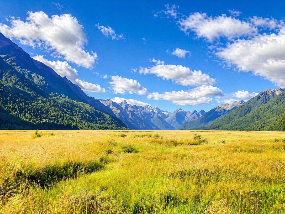
Scale is the part visitors consistently underestimate. The park is larger than several European countries and contains three of New Zealand's ten Great Walks. Almost none of it is reachable by car. The Milford Road, State Highway 94, is the only sealed road that penetrates the park to a fiord, and it exists because of a tunnel driven through solid rock at the head of the Hollyford Valley.
| Feature | Figure | What it means in practice |
|---|---|---|
| Park area | Over 12,500 km² | New Zealand's largest national park by a wide margin |
| Milford Sound length | About 16 km, head to open sea | A standard cruise covers the full length and turns around |
| Mitre Peak height | 1,692 m | Rises straight from the water, no foothills |
| Annual rainfall | Around 7 metres | Among the wettest inhabited places on earth |
| Roads into the fiords | One (SH94, to Milford) | Every other fiord needs a boat, a plane or a multi-day walk |
What Does The Department Of Conservation Control At Milford?
DOC manages the land, the tracks, the huts and the concessions that let commercial operators work in the park. It does not run the cruises. The boats, flights and kayak trips are commercial businesses licensed to operate inside a protected area, which is why capacity is capped and standards are enforced.
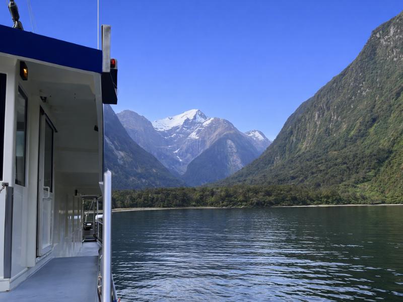
This has direct consequences for booking. The Great Walk huts on the Milford Track are DOC facilities with a booking system that opens months ahead and sells out for the summer season within hours. Independent walkers book huts; guided walkers book through the licensed operator that runs the private lodges. Those are two different systems and they are not interchangeable.
Day visitors interact with the concession system without noticing it. The operator caps are the reason a fiord receiving over a million visitors a year can still feel quiet from a boat deck at the right hour. Vessel numbers on the water at any moment are limited, and the busiest window is a predictable midday block when the Queenstown coaches converge.
Which Parts Of The Park Can You Actually Reach In A Day?
From Te Anau, comfortably: the Milford Road stops, the fiord itself by boat, and a short walk such as The Chasm or a section of the Milford Track. From Queenstown, the same list but with four hours of driving at each end, which is why so many people fly one leg instead.
The realistic day-trip inventory is smaller than people expect, and the road stops are a genuine part of it rather than filler. Mirror Lakes, Monkey Creek, the Eglinton Valley and the Homer Tunnel approach are all on the way in, and a well-run coach day builds them into the schedule rather than driving past them.
| From | Distance to Milford | Driving time one way | Typical full day |
|---|---|---|---|
| Te Anau | About 120 km | Around 2 hours | 8 to 10 hours |
| Queenstown by road | About 290 km | Around 4 hours | 12 to 13 hours |
| Queenstown by air | Direct flight | Roughly 35 to 40 minutes | About 5 hours |
What Lives In The Park That You Might Actually See?
New Zealand fur seals are close to guaranteed on a cruise, hauled out on the rocks near the fiord mouth. Bottlenose dolphins are frequent but not certain. Fiordland crested penguins are seasonal and much less common. Kea, the alpine parrot, hang around the Homer Tunnel approach.
Fiordland's isolation is why its wildlife is unusual rather than merely abundant. The park is a stronghold for species that struggle elsewhere, including takahē, which were believed extinct until a population was rediscovered in the Murchison Mountains inside this park in 1948. You will not see one from a cruise boat, but the fact that they persist here says something about how little of the park has been altered.
What you realistically see from the water is more modest and still worth the trip. Seals on Seal Rock, waterfalls running off the cliffs, and if the light cooperates, the reflection of the walls in a fiord surface that goes glassy in calm conditions.
How Does The Rain Shape The Park?
Around seven metres of rain a year is what makes Fiordland look like Fiordland. The rainforest clings to bare rock because constant moisture lets it, and the hundreds of temporary waterfalls that appear during and after heavy rain are the single most dramatic thing the fiord does.
Two waterfalls run permanently: Stirling Falls and Lady Bowen Falls. Everything else on the walls is weather-dependent. After sustained rain the cliffs stream with water in every direction, which is the version of Milford Sound that appears in most of the photography people remember.
This inverts the usual travel logic. A wet day at Milford Sound is not a spoiled day. Rain is the reason the place is spectacular, and the operators run in it as a matter of routine. What genuinely disrupts a visit is wind strong enough to affect marine safety, or low cloud that grounds aircraft.
Do You Need A Permit Or Pass To Enter The Park?
No. There is no entrance fee and no permit for day visitors to Fiordland National Park, unlike many national parks overseas. You pay for what you do inside it: the cruise, the flight, the kayak trip, or the hut bookings if you are walking a Great Walk.
Parking at the Milford Sound terminal is the one charge that catches people out, and it is worth checking the current arrangement before you drive yourself. Anyone arriving on a coach or a tour has this handled as part of the trip.
For walkers, the picture is different. The Milford Track operates on a strict one-way, date-specific booking system during the Great Walk season, and hut bookings are the limiting factor rather than any park entry. Day walks on sections of the track need no booking at all.
Is The Park Worth Building A Trip Around, Or Just A Day?
Most visitors give Fiordland one day and see Milford Sound. Two to three days lets you add Doubtful Sound or a serious day walk. Four or more starts to make sense only if you are walking one of the Great Walks or you want weather insurance for a scenic flight.
Weather insurance is the argument for extra time that people underestimate. Cruises run in almost all conditions, but flights do not, and a single-day visit built around a scenic flight has no fallback if the cloud sits low. Basing yourself nearby for two nights turns a weather cancellation from a lost experience into a rescheduled one.
If you have exactly one day and you are starting from Queenstown, the honest options are a long coach day or a much shorter flight-based day at roughly double the price. Both work. Which one suits depends on whether you want the road, with its stops and its scenery, to be part of the trip or not.
How Does Fiordland Compare With New Zealand's Other National Parks?
It is the largest by a wide margin and the least road-served. Aoraki Mount Cook has a village and a road to the glaciers. Tongariro has a crossing you can walk in a day. Fiordland has one road to one fiord, and the rest is reached on foot, by boat or by air.
| Park | Approx area | Road access | Character |
|---|---|---|---|
| Fiordland | Over 12,500 km² | One sealed road to one fiord | Fiords, rainforest, extreme rainfall |
| Mount Aspiring | Around 3,500 km² | Road access to several valleys | Alpine, glaciers, Great Walk terrain |
| Aoraki Mount Cook | Around 700 km² | Sealed road to a village | High peaks, glacial valleys |
| Westland Tai Poutini | Around 1,300 km² | State highway along the coast | Glaciers reaching near sea level |
The first three of those, together with Fiordland, make up the Te Wahipounamu World Heritage Area. They are administered separately but recognised as one continuous natural region, which is why the same species and the same glacial story turn up across all four.
For a visitor the practical difference is effort. In most New Zealand parks you can drive to several trailheads and choose your day. In Fiordland the road decides for you, which is why the fiord and the Milford Road carry almost all of the visitation while the other 95 percent of the park sees almost nobody.
What Are The Other Fiords, And Can You Visit Them?
There are fourteen major fiords. Only Milford has road access. Doubtful Sound is reachable by a boat and coach transfer via Manapouri, and the rest, including Dusky, Breaksea, Chalky and Preservation, require a multi-day boat charter, a float plane or a serious tramping expedition.
| Fiord | How you reach it | Realistic visitor access |
|---|---|---|
| Milford Sound / Piopiotahi | State Highway 94 | Day trip by car, coach or air |
| Doubtful Sound / Patea | Lake Manapouri crossing, then Wilmot Pass | Full-day or overnight trip |
| Dusky Sound | Charter boat, float plane, or the Dusky Track | Multi-day, specialist |
| Breaksea, Chalky, Preservation | Charter or expedition cruise | Rare, expensive, weather-bound |
Doubtful Sound is the only realistic second fiord for most itineraries, and it is genuinely different rather than a repeat. It is larger, has three distinct arms, receives a fraction of Milford's visitors and is often described as quieter in a way that is not just about numbers: the transfer over Wilmot Pass filters out anyone who was not committed. It is a separate booking from anything at Milford, so if you want both, check the Doubtful Sound coach and cruise dates here before you fix your Te Anau nights.
What Is The Conservation Story Here?
Fiordland's isolation has made it a refuge for species that vanished elsewhere. The most famous case is the takahē, a large flightless bird declared extinct and then rediscovered in the Murchison Mountains inside this park in 1948, which remains one of the defining moments in New Zealand conservation.
The ongoing work is less dramatic and more relentless: predator control. Stoats, rats and possums arrived with Europeans and devastated ground-nesting birds that had evolved with no mammal predators at all. Trapping and monitoring across huge, roadless country is what keeps the remaining populations viable.
Visitors intersect with this in small ways. Boot-cleaning stations, rules about where you can take a dog, and the biosecurity checks on boats going into the fiords are all part of the same effort. None of it is arduous, and it is the reason the birdlife you hear on the Milford Track is still there to hear.
What Rules Apply To Visitors Inside The Park?
The main ones: no drones without a concession, no dogs in most areas, no rubbish left behind, no freedom camping outside designated sites, and no taking anything out, including stones and plants. None of it is onerous, and the drone rule is the one visitors most often break unknowingly.
| Rule | What it means in practice |
|---|---|
| Drones | Need a Department of Conservation concession; casual recreational flying is not permitted |
| Dogs | Not permitted in most of the park, to protect ground-nesting birds |
| Camping | Designated campsites only; freedom camping is restricted along the Milford Road |
| Rubbish | Carry everything out; there is minimal waste infrastructure at Milford |
| Natural material | Leave rocks, plants and pounamu where they are |
The pounamu point is worth stating plainly, because the fiord is historically a greenstone source and visitors sometimes assume a small stone is a souvenir. Pounamu in the South Island is owned by Ngāi Tahu under the settlement legislation. Taking it is not a technicality.
How Does The Park Handle Its Own Popularity?
Through concessions and caps rather than gates. Vessel numbers on the fiord are limited, commercial operators work under permits, and the Great Walk huts are booked to capacity months ahead. There is no visitor cap on the road itself, which is why the car park feels busier than the water.
This produces the central paradox of a Milford Sound day. Well over a million people a year come to a place with no town, and the experience on the water still holds up, because the bottleneck was moved to the boats rather than left at the entrance.
Where it does not hold up is the terminal at midday. Infrastructure at the fiord has been debated for years precisely because the road delivers people faster than the site can absorb them in a narrow window. Travelling outside that window is the single most effective thing an individual visitor can do about it.