Where Is Milford Sound?
Milford Sound looks close to Queenstown on a map and is not. The gap between how far it looks and how long it takes is the single most common planning mistake people make, and it is entirely down to the shape of the mountains in between.
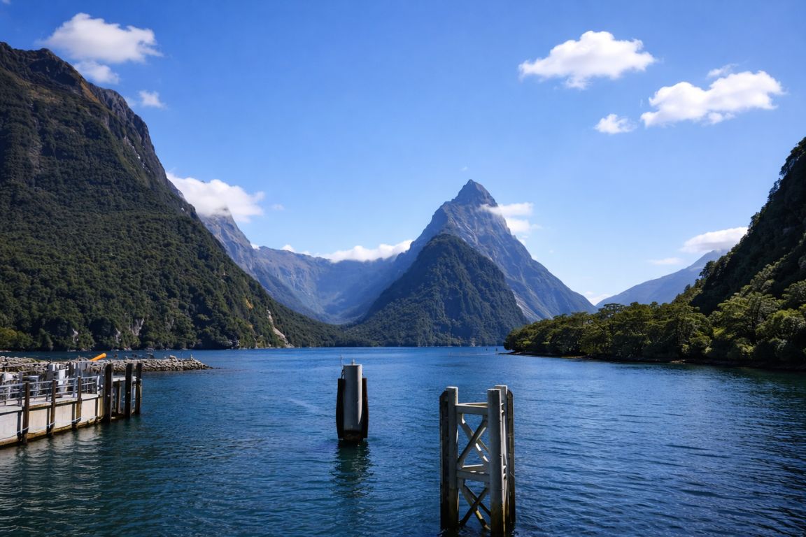
Milford Sound is on the southwest coast of New Zealand's South Island, inside Fiordland National Park, about 120 kilometres by road from Te Anau and about 290 kilometres from Queenstown. The driving times are roughly two hours and four hours respectively, each way.
Choose your starting point first, then compare a full Queenstown coach day, a shorter flight-based visit, or a Te Anau departure that cuts the road time.
Your Milford Plan
- Allow about four hours each way by road from Queenstown, plus time for the cruise, stops and Homer Tunnel delays.
- Use Te Anau when Milford is the focus because it halves the driving and opens earlier cruise options.
- Confirm the experience for your actual travel date before arranging other transport or accommodation.
The location is easy to state and hard to picture, because Fiordland is one of the least road-served regions in a country that is otherwise straightforward to drive around. Milford Sound is the only fiord in the park you can reach in a car, and the road that gets you there takes a long way around a mountain range rather than through it.
Where Exactly Is Milford Sound On The Map?
It sits at the northern end of Fiordland National Park, in the Southland region, on the Tasman Sea coast. The fiord runs roughly 16 kilometres inland. The nearest settlement of any size is Te Anau, and the nearest city is Invercargill, about 150 to 160 kilometres south of Te Anau.
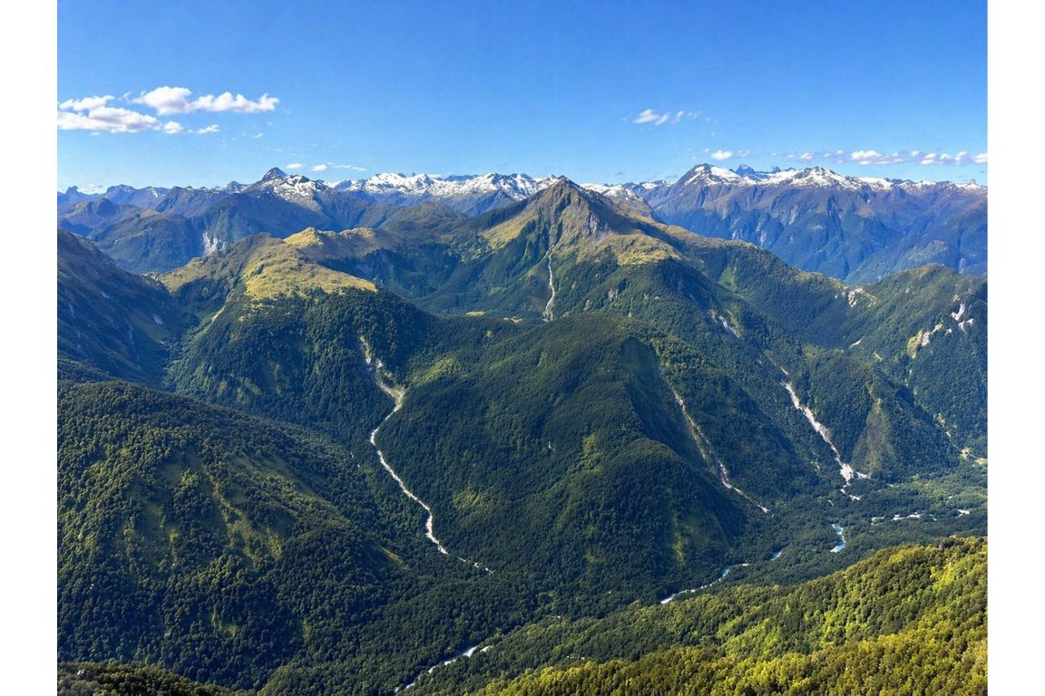
On a map of the South Island, Milford is up and to the left of Queenstown, hard against the west coast. The apparent straight-line distance from Queenstown is around 65 kilometres. The road distance is over four times that, because the direct line crosses the Southern Alps and there is no road across them at that point.
That single fact explains most of the logistics of visiting. Everything else, the long coach days, the popularity of flights, the argument about whether to base yourself in Te Anau, follows from the geography.
| From | Straight line | By road | Driving time one way |
|---|---|---|---|
| Queenstown | Around 65 km | About 290 km | Around 4 hours |
| Te Anau | Around 60 km | About 120 km | Around 2 hours |
| Invercargill | Around 170 km | About 280 km | Around 3.5 to 4 hours |
| Christchurch | Around 430 km | About 730 km | Around 9 to 10 hours |
Why Is The Drive So Much Longer Than The Map Suggests?
Because the road has to go south around the Southern Alps, down to Te Anau, and then back north into the mountains. From Queenstown the route runs through Kingston, Lumsden and Mossburn before it even reaches Te Anau, and only then does the Milford Road begin.
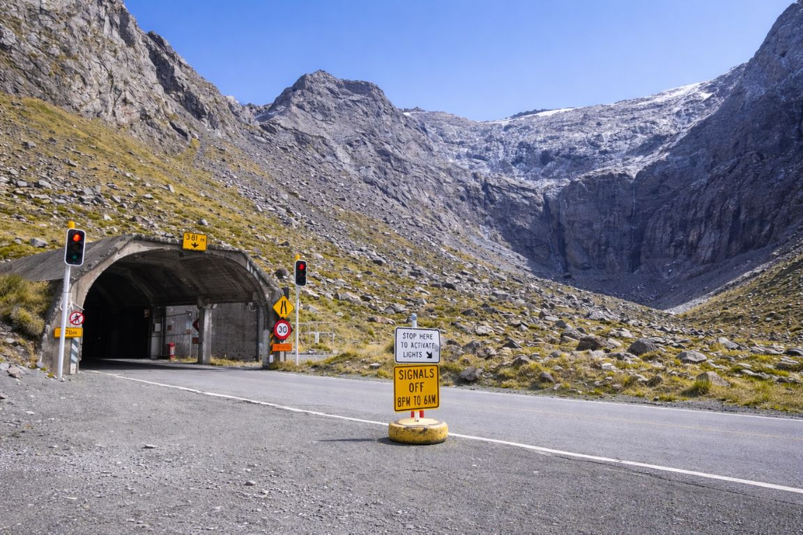
The final stretch is the reason the whole thing works at all. State Highway 94 runs north from Te Anau up the Eglinton Valley, climbs toward the Divide, and then passes through the Homer Tunnel, a 1.2 kilometre bore driven through solid rock. Without that tunnel there would be no road access to Milford Sound whatsoever.
The tunnel is single-lane and traffic-light controlled in the peak season, which adds waiting time in both directions. It also descends steeply on the Milford side through a series of tight switchbacks. None of this is difficult driving in good conditions, but it is slow, and it is why estimates that assume open-road speeds are wrong.
How Long Does It Really Take From Queenstown?
Four hours of driving each way is the honest figure, and a realistic day trip runs twelve to thirteen hours door to door once you add the cruise, the stops and the Homer Tunnel wait. Coach tours from Queenstown are built around exactly that shape.
The gap between four hours of driving and thirteen hours of day is where people get caught out. A two-hour cruise, a lunch stop, three or four roadside stops and a tunnel queue add up. Anyone planning to drive themselves from Queenstown, do the cruise and drive back should budget the full day and leave very early.
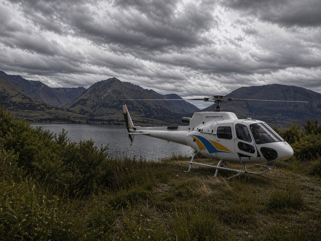
The alternative is to remove the road from the equation. A flight from Queenstown covers the same ground in roughly 35 to 40 minutes each way, which is why a fly-cruise-fly day runs about five hours in total rather than thirteen. It costs substantially more and it is weather-dependent, which is the trade.
| Approach from Queenstown | Total day | Time on the water | Weather risk |
|---|---|---|---|
| Coach and cruise | 12 to 13 hours | Around 2 hours | Low, runs in almost all conditions |
| Fly one way, coach the other | Around 8 to 9 hours | Around 2 hours | Medium, flight leg can be swapped for road |
| Fly both ways | Around 5 hours | Around 2 hours | Higher, cancels in low cloud or wind |
Where Is The Closest Town To Milford Sound?
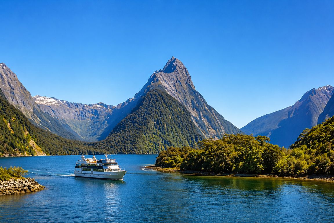
Te Anau, about 120 kilometres and two hours south, is the closest town of any size and the accepted gateway to Fiordland. Milford Sound itself has a boat terminal, an airstrip and a lodge, but it is not a town: there is no supermarket, no fuel you should count on and no general accommodation.
Manapouri sits about twenty minutes south of Te Anau and is the departure point for Doubtful Sound trips rather than Milford. Queenstown, despite being where most visitors sleep, is four hours away and is best understood as a base you commute from rather than a nearby town.
The practical implication is fuel and food. Fill up in Te Anau. Bring what you want to eat unless your trip includes a meal. Expect mobile coverage to disappear for much of the drive and not to return reliably at Milford.
Which Airport Do You Fly Into?
Queenstown Airport is the main gateway, with the widest range of domestic connections and some Australian routes. Invercargill and Dunedin are alternatives if you are approaching from the south. Milford Sound has an airstrip, but it serves scenic flights and transfers rather than scheduled airline service.
Most international visitors arrive in Auckland or Christchurch and connect to Queenstown. From there the choice is the road or a scenic flight. Because Queenstown Airport is also where the Milford flights depart, flying in and flying out to the fiord fit together neatly for anyone short on time.
Is Milford Sound In The Southern Alps?
Not quite. The Southern Alps run up the spine of the South Island and taper toward Fiordland, where the range takes on a different character. The peaks around Milford are part of the same broad mountain system, but Fiordland's geology and its glacial history give it a distinct shape.
What you see around the fiord is the result of ice rather than altitude. The peaks here are lower than Aoraki Mount Cook, several hundred kilometres northeast, but they rise from sea level rather than from a high valley floor, so the visible relief is dramatic. Mitre Peak's 1,692 metres is not a big mountain by New Zealand standards. It looks enormous because there is nothing between its summit and the water.
How Far Is Milford Sound From Doubtful Sound?
They are neighbouring fiords roughly 40 kilometres apart in a straight line, but there is no road between them. Reaching Doubtful Sound means driving to Manapouri, crossing Lake Manapouri by boat, then travelling over Wilmot Pass by coach. Doing both fiords in one day is not realistic.
The access difference is the main practical distinction between the two. Milford is a road destination with a two-hour cruise. Doubtful is a half-day or full-day commitment before you are even on the fiord, which is exactly why it stays quieter.
| Milford Sound | Doubtful Sound | |
|---|---|---|
| Road access | Yes, SH94 to the terminal | No, boat and coach transfer via Manapouri |
| Typical time commitment | Half day plus travel | Full day minimum |
| Scale | Steeper, more concentrated | Larger, more arms, quieter |
| Visitor numbers | Far higher | Substantially lower |
What Is The Drive In Actually Like?
Sealed the whole way, scenic from the moment you leave Te Anau, and slower than the distance suggests. The Eglinton Valley opens out into flat grassland framed by mountains, then the road climbs through beech forest to the Homer Tunnel and drops steeply to the fiord.
Standard stops along the way include Mirror Lakes, Knobs Flat, Monkey Creek and the Homer Tunnel approach, where kea often appear. The Chasm, a short walk over churned rock near the Milford end, takes about twenty minutes return. A well-planned self-drive builds in two hours of stops on top of the driving time.
In winter the picture changes. Snow chains are required to be carried on the Milford Road from May onward, avalanche risk closes the road periodically, and the descent from the tunnel can be icy in the morning. None of that makes the drive unreasonable, but it makes a guided small-group tour from Queenstown more attractive for anyone who is not confident in alpine conditions.
Should You Base Yourself In Te Anau Or Queenstown?
Te Anau if Milford Sound is the point of the trip, Queenstown if it is one item in a wider South Island itinerary. Basing in Te Anau halves the driving, opens up the early morning cruise slots and makes a weather cancellation recoverable. Queenstown gives you a real town with everything else in it.
The early cruise argument is the strongest one for Te Anau. The busiest window on the water is the middle of the day, when the Queenstown coaches arrive together. Staying two hours closer means you can be on a morning departure before that pattern builds.
How Does Milford Compare With Other South Island Drives?
It is one of the longer day-trip drives in the country and by far the slowest per kilometre. Four hours each way from Queenstown is comparable in time to driving Queenstown to Christchurch, for a fraction of the distance.
| Route | Distance | Typical driving time |
|---|---|---|
| Queenstown to Milford Sound | About 290 km | Around 4 hours |
| Queenstown to Te Anau | About 170 km | Around 2 to 2.5 hours |
| Te Anau to Milford Sound | About 120 km | Around 2 hours |
| Queenstown to Wanaka | About 70 km via the Crown Range | Around 1 hour |
| Queenstown to Christchurch | About 480 km | Around 6 hours |
The comparison that matters is the last stretch. Those 120 kilometres from Te Anau take two hours because of the terrain, the tunnel and the stops, not because the road is poor. Planning on open-road speeds is the single most common timing error.
What Is The Route From Christchurch Or Dunedin?
Both are long enough that Milford is not a day trip. From Christchurch it is roughly 730 kilometres and nine to ten hours of driving to the fiord, so almost everyone breaks the journey at Queenstown or Te Anau.
From Dunedin the drive is shorter but still well beyond day-trip range, and the sensible approach is the same: get to Te Anau, sleep, then do the fiord fresh the next morning. Attempting it in one push means arriving too late for a cruise and driving the best scenery in the dark.
Is There Public Transport To Milford Sound?
No scheduled public bus service in the way you would find between cities. Access is by private vehicle, by tour coach, or by air. For anyone without a car, a coach tour from Queenstown is effectively the public transport option.
This is not a gap in the network so much as a reflection of where the road goes. It ends at a terminal inside a national park with no resident population, so the vehicles running it are carrying visitors rather than commuters.
For travellers without a car, that simplifies the decision considerably. The choice is a coach day from Queenstown or from Te Anau, or a flight, and both include the cruise as part of the package.
What Are The Waypoints Along The Milford Road?
The road from Te Anau runs about 120 kilometres with a well-established sequence of stops. Knowing the order helps you pace the drive, because the best of them are clustered in the second half and it is easy to spend all your time in the first.
| Waypoint | Approx km from Te Anau | Worth stopping? |
|---|---|---|
| Te Anau Downs | About 30 km | Milford Track boat departure point |
| Eglinton Valley | About 50 km | Yes, the classic flat valley view |
| Mirror Lakes | About 58 km | Yes, short boardwalk, best in still weather |
| Knobs Flat | About 65 km | Toilets, information |
| Lake Gunn | About 77 km | Short forest loop walk |
| The Divide | About 85 km | Routeburn and Key Summit trailhead |
| Monkey Creek | About 95 km | Yes, clear water, kea often present |
| Homer Tunnel | About 100 km | The crossing point; expect a light wait |
| The Chasm | About 110 km | Yes, 20 minute return walk |
| Milford Sound terminal | About 120 km | The destination |
A sensible plan is to drive most of the way in with only a brief stop, make the cruise, and take the stops properly on the way back when there is no deadline. The alternative, stopping at everything on the way in, is how people miss boats.
How Does The Homer Tunnel Actually Work?
It is a single-lane tunnel roughly 1.2 kilometres long, unlined and rough-walled, running downhill toward Milford. In peak season traffic lights alternate the direction of travel, and waits of ten to twenty minutes each way are normal.
The tunnel was driven through the rock over several decades from the 1930s, interrupted by avalanches and the war, and it is the sole reason a road reaches Milford Sound at all. Standing at the eastern portal, hemmed in by walls with no obvious way forward, makes that history immediately legible.
Beyond the western end the road drops steeply through a series of switchbacks to the Cleddau Valley. In winter that descent holds ice in the morning, and it is the section where drivers unfamiliar with alpine roads get into difficulty. Kea congregate at both portals and will damage rubber trim on parked cars, so keep windows closed and do not feed them.
Where Can You Get Fuel And Supplies?
Te Anau, and effectively nowhere else. Fill the tank there in both directions. There is no supermarket beyond it, mobile coverage disappears for most of the route, and what is available at Milford is limited and expensive.
| Service | Last reliable point |
|---|---|
| Fuel | Te Anau |
| Supermarket | Te Anau |
| Mobile coverage | Patchy after Te Anau, effectively none from the Eglinton Valley on |
| Toilets | Several roadside stops, including Knobs Flat and the terminal |
| Food for sale | Limited service at the Milford terminal |
Can You Approach From The West Coast Or Haast?
Not directly. Despite Milford sitting on the west coast, there is no coastal road connecting it northward. Anyone coming down the West Coast through Haast must travel inland via Wanaka and Queenstown, then south to Te Anau, and approach the way everyone else does.
This surprises people looking at a map, because the coastline appears continuous. It is not driveable: the terrain between Milford and the Haast region is the roadless heart of two national parks.
How Does Milford Fit Into A South Island Route?
Most commonly as a spur off Queenstown or a night in Te Anau on the way between Queenstown and the Catlins or Invercargill. It is rarely on the way to anywhere, because the road in is the road out.
| Route shape | How Milford fits |
|---|---|
| Queenstown base, day trips | One long day, or a flight; no repacking |
| Queenstown to Te Anau to Queenstown | One or two nights in Te Anau, much shorter days |
| Queenstown to Te Anau to Invercargill or the Catlins | Milford as a spur from Te Anau, then continue south |
| West Coast southbound | Inland via Wanaka and Queenstown; no coastal route exists |
What Are The Common Navigation Mistakes?
Three: trusting a mapping app's drive time without allowing for stops and the tunnel, assuming fuel exists past Te Anau, and relying on live navigation in a place with no signal. All three are avoidable with fifteen minutes of preparation.
Mapping apps typically quote the driving time only. They do not know about the tunnel light cycle, that you will want to stop at Mirror Lakes, or that a coach ahead of you will slow the descent. Add at least ninety minutes to whatever the app says if you intend to enjoy the trip.
Download offline maps before leaving town, note your cruise check-in time somewhere that does not need a connection, and tell someone your plan if you are driving in winter. None of this is dramatic. It is the same preparation any alpine road deserves.